When I returned to Queenstown I had a month left in New Zealand. I saw less of everyone I knew. The rest of the group were working most every day and sleeping three-up in the car. I spent a few nights sleeping in the woods and then a couple of weeks in a hostel in order to do a bit of remote work.
Before leaving I wanted to see some more of the South Island and planned a route up the West Coast. The first part, crossing the mountains out of Queenstown, was to be on foot. Before New Zealand I would not have thought it within my capabilities. After the Routeburn Track it seemed possible, just. Once Kris and Saunders dropped me at the start of the Rees Track the transition to a solo trip was complete.
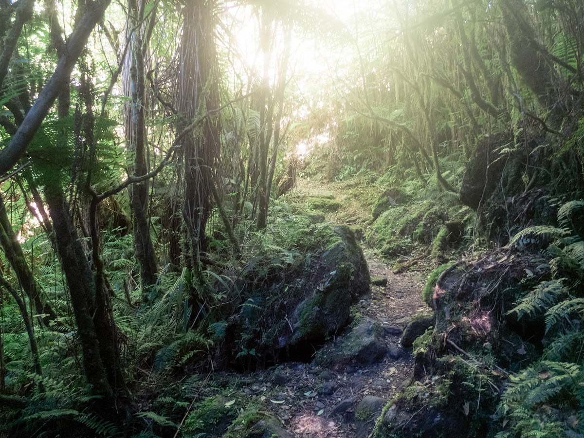
It was a flat, boggy and lonely walk to the first hut. As usual no-one there was actually from New Zealand but a couple of older guys from Melbourne were very hospitable and we played cards well into the headtorch territory of the night.
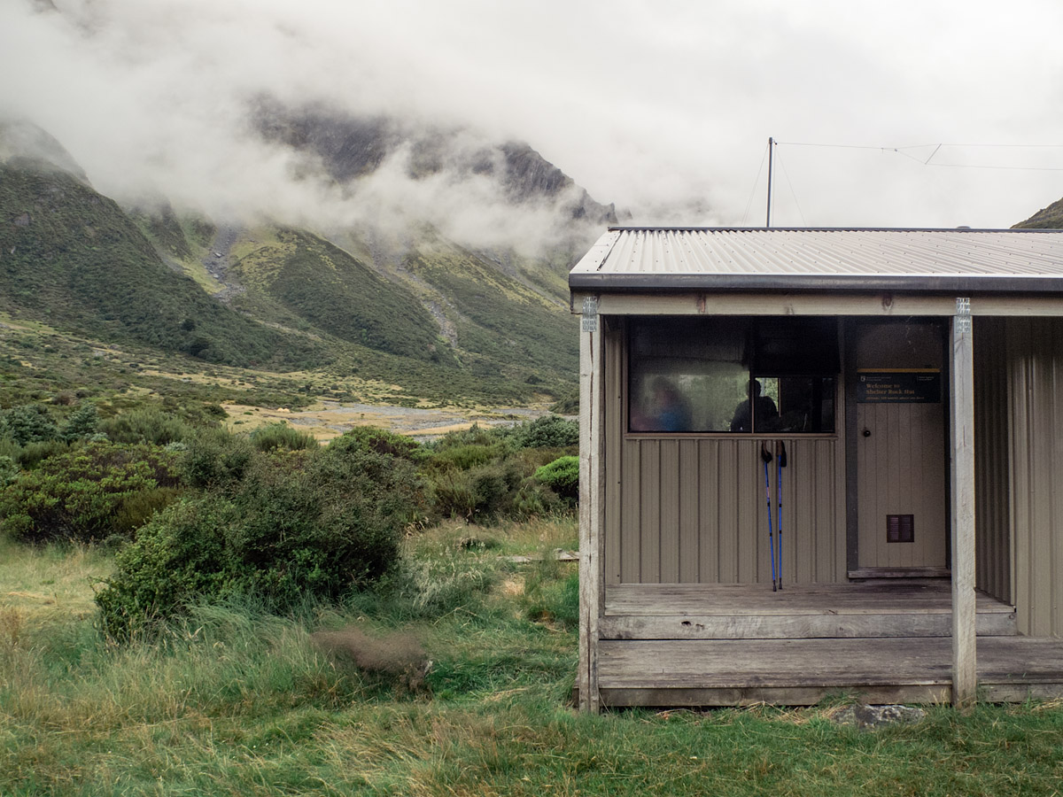
In the morning I walked to the second hut, climbing up and down the Rees Saddle in fine conditions. There I took a long lunch (five fruit and oat cookies, salami, e-reader) and set off again when the weather had exhausted any promise of improvement.
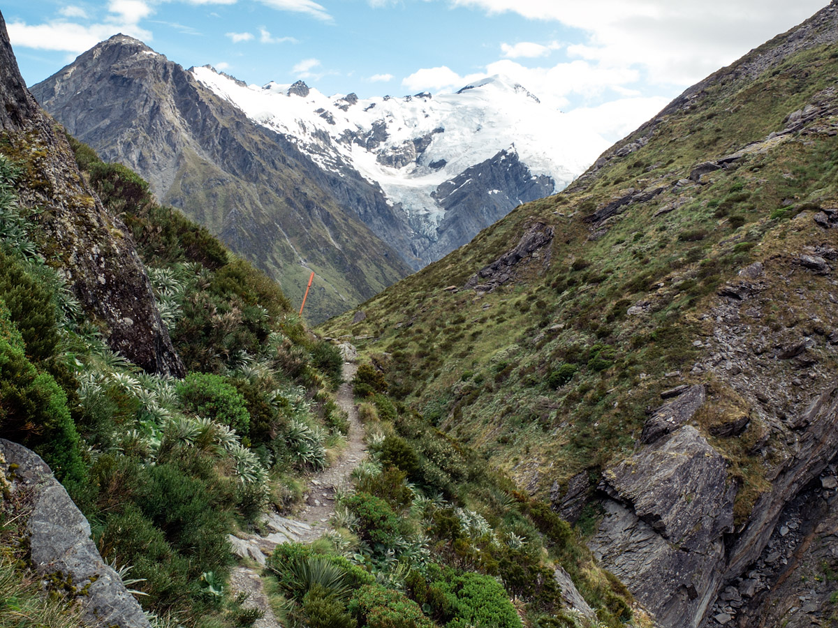
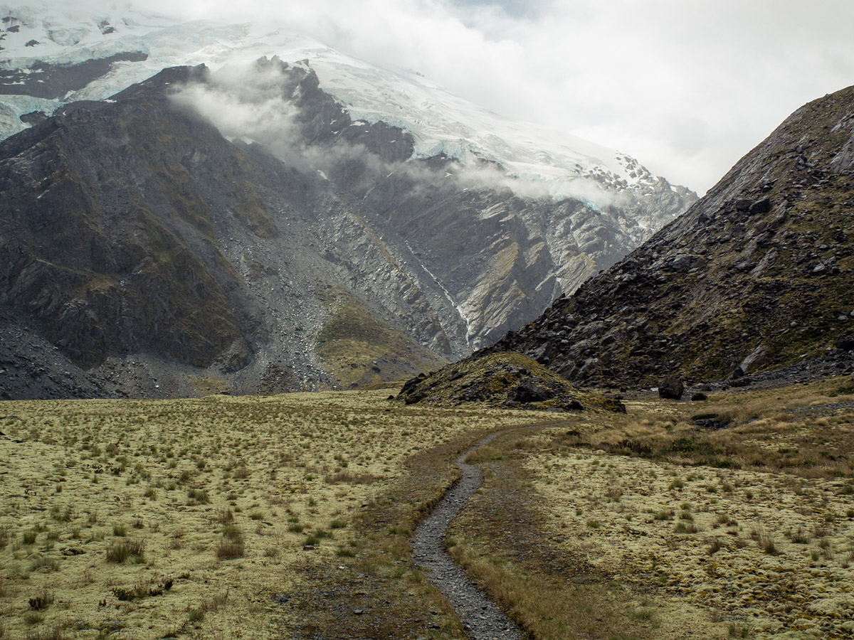
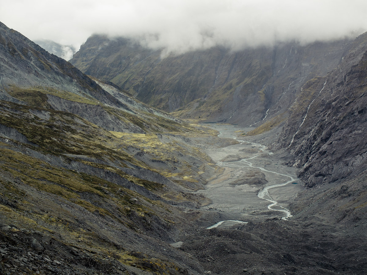
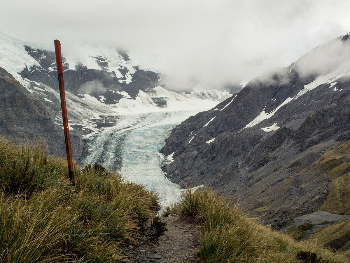
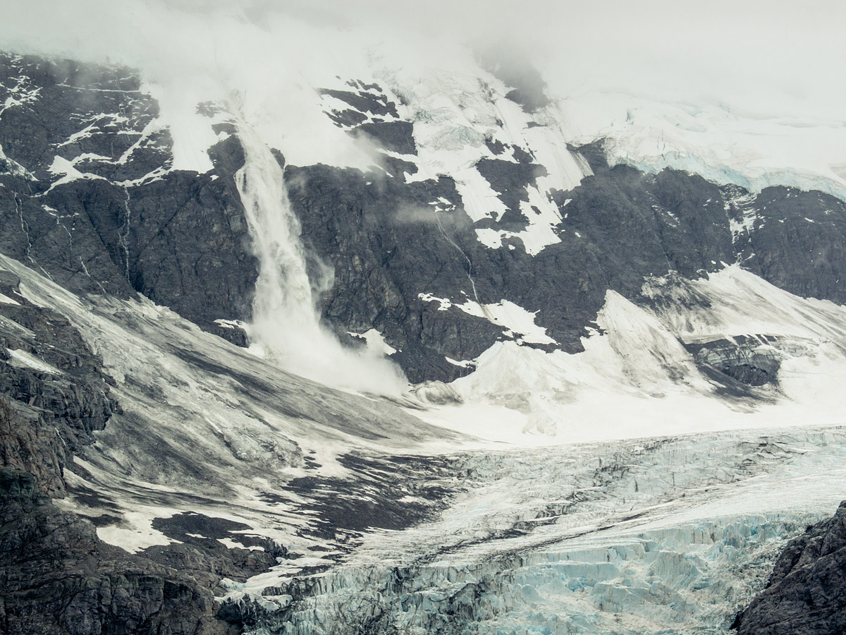
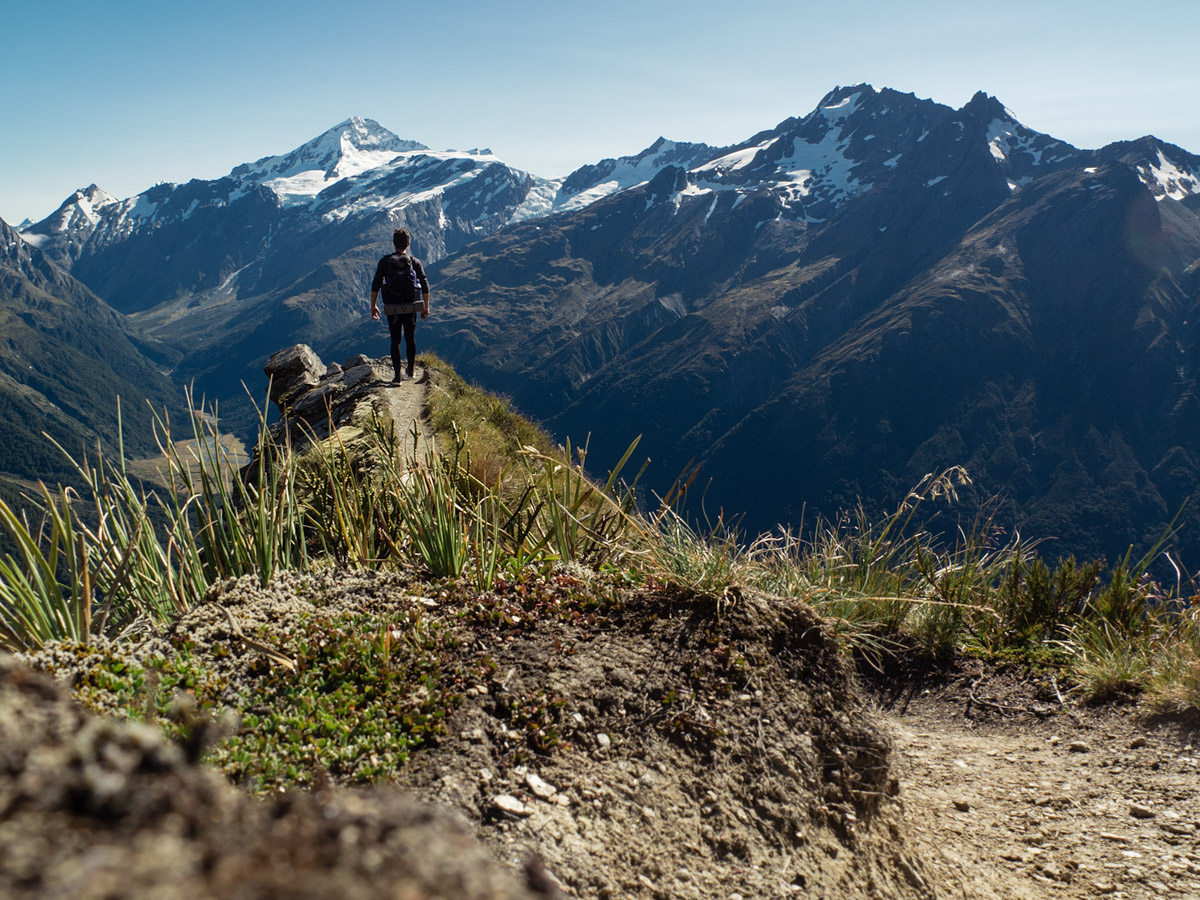
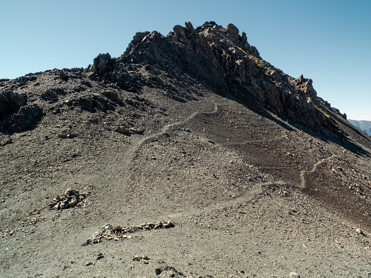
The track followed the valley to the tongue of the Dart Glacier. Even without the clouds over the tops it would have been an ominous landscape, but they descended and broke into rain. Waterfalls ran thin and tall down the dark moraine cliffs to the loose, rocky ground where little grew. The track turned out of the valley, up towards Cascade Saddle and an awe-inspiring view over the glacier. Avalanches above twice waterfalled onto it, sounding across the valley with a great roar. It was an inhuman place—beautifully so—and I was its only human witness.
Reaching Cascade Saddle was the second 500m+ climb of the day. It nearly broke me. Continuing was a case of being objective: I’m not finding the track hard, it is the track that is, itself, hard.
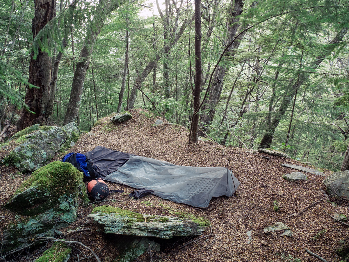
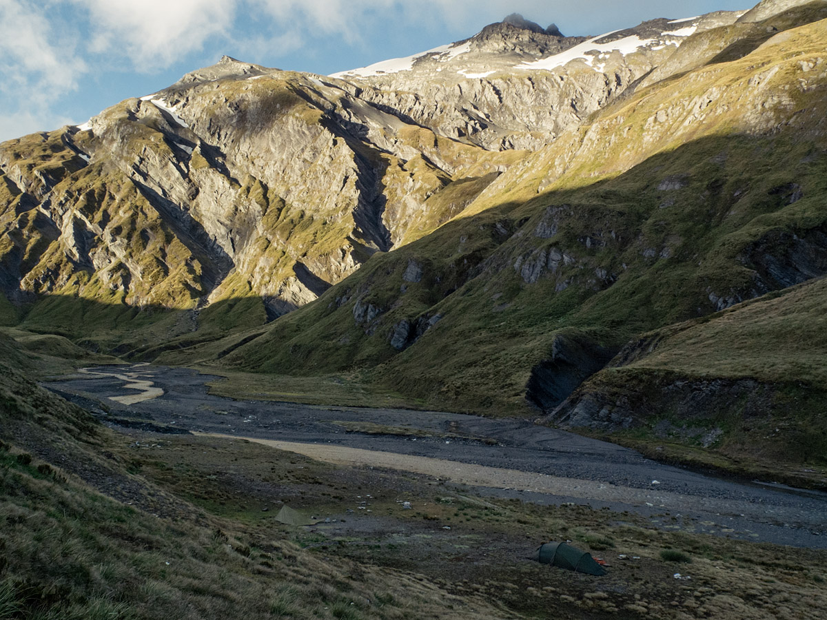
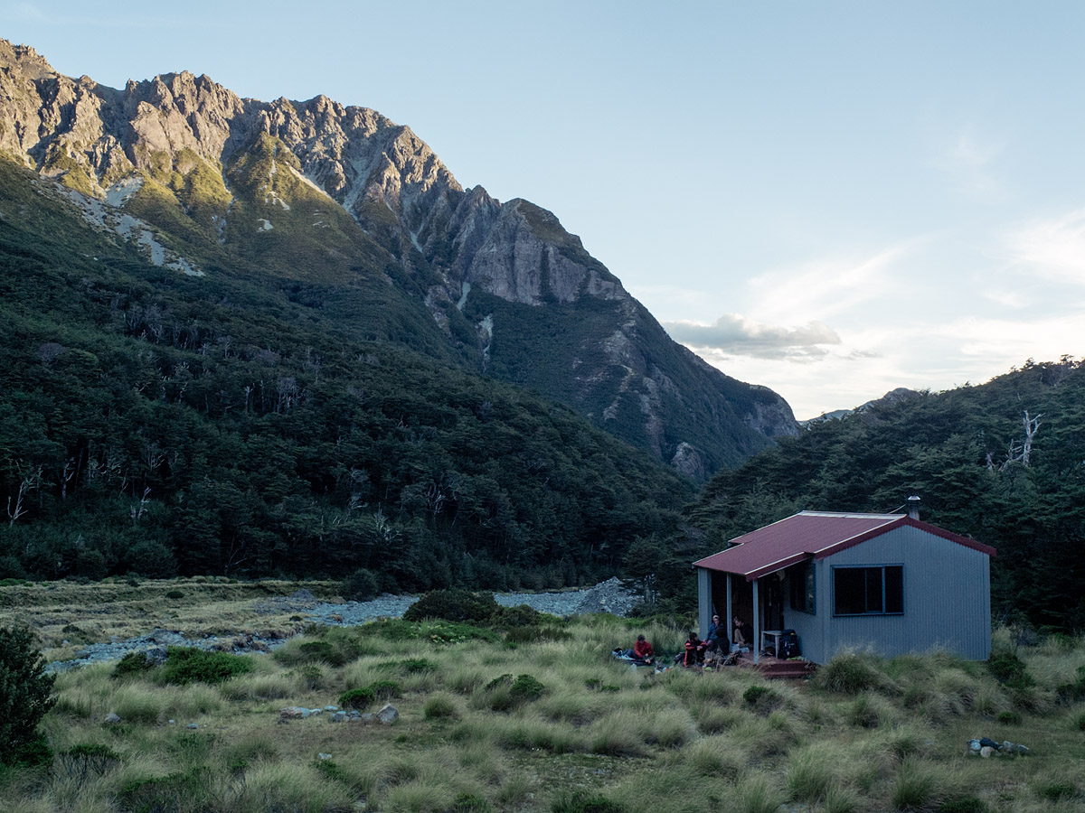
There were still a few kilometers to go laterally and a couple hundred metres to go vertically before the spot where it was recommended to camp. When I got there it was not in the lee of the wind as I had hoped, and, unfortunately, the biggest river crossing of the day was immediately before the site. So I arrived with soaking shoes and frigid feet.
I made a miserable and slightly hypothermic effort at setting up my tarp before a lovely Swiss couple, the only others camping at the same spot or anywhere on the track, invited me to sit in their tent with them and fed me endless cups of hot tea until I was warm. I had another go at the tarp and though it was a shelter ill-suited to the alpine environment I stayed dry in the rain and warm in the cold and the morning was worth the night.
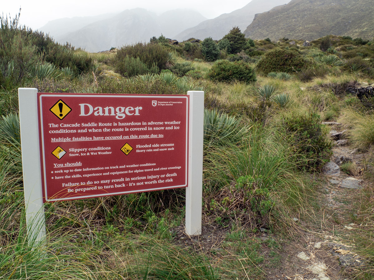
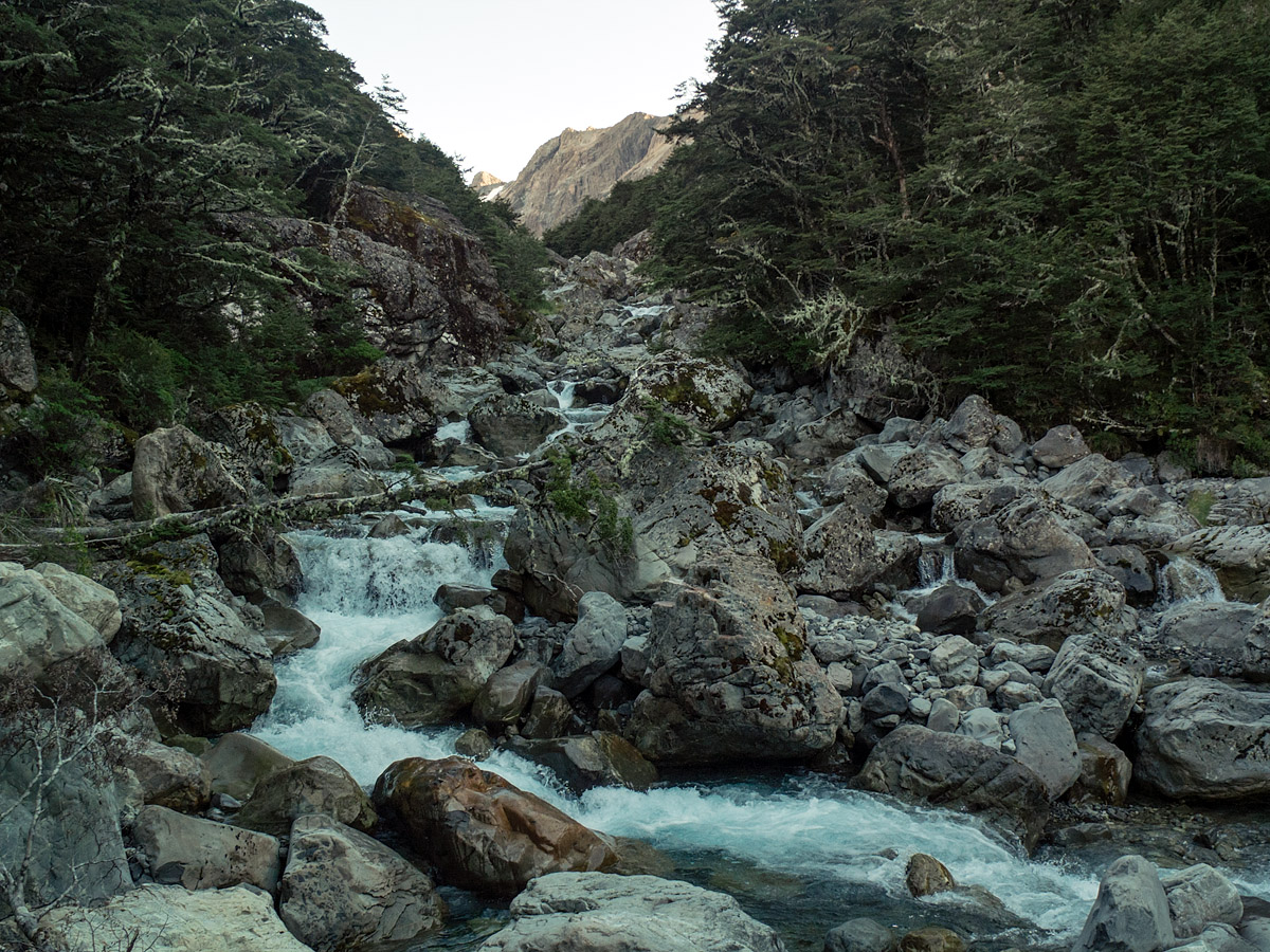
I woke early, still in the shadow of the mountains, but for there to be shadow there had to be sun. I said goodbye to my Swiss friends and headed for the bottom of next valley. In worse conditions people have died coming up or down this section. It’s not as bad as the warning signs make out—I hadn’t even expected a track—but it did drop 1400m over 5km and two hours. Including the subsequent walk to the car park that gave me a total of 55km over two full days and a sense of achievement that would carry me into the next leg of the adventure.
Untitled
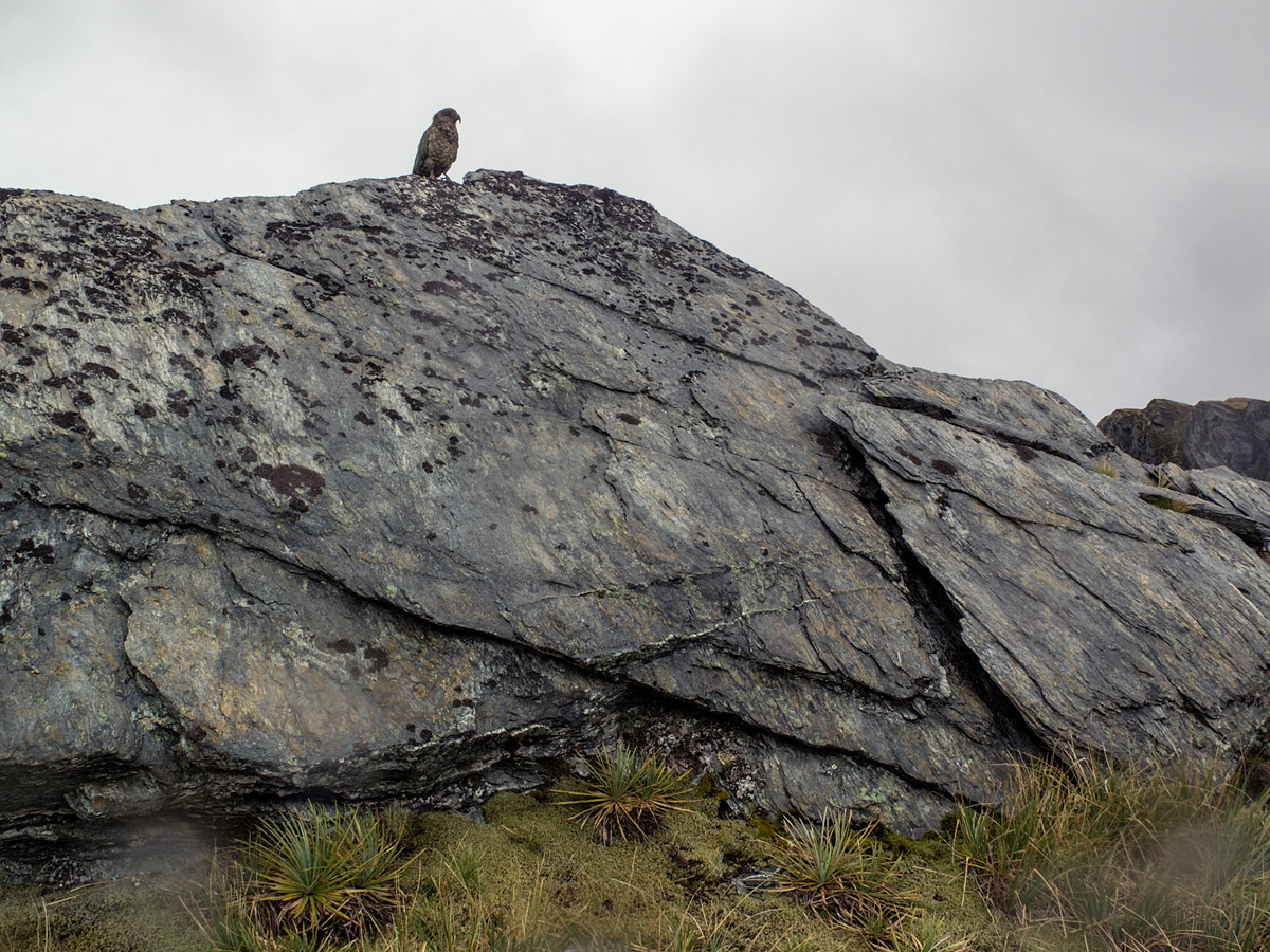
I had my camera set up to take a self-timer picture. This is the first photo I took after the Kea tried to pick it up and sent it tumbling down the face of the rock.
—
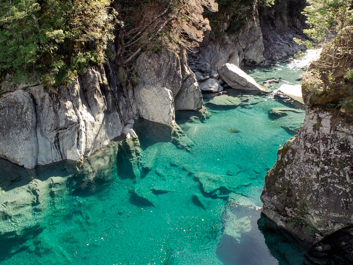
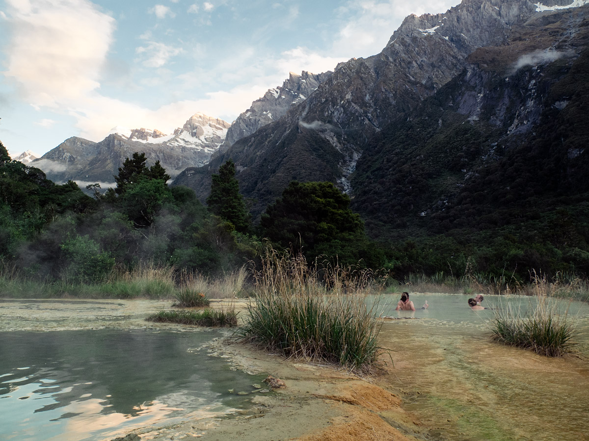
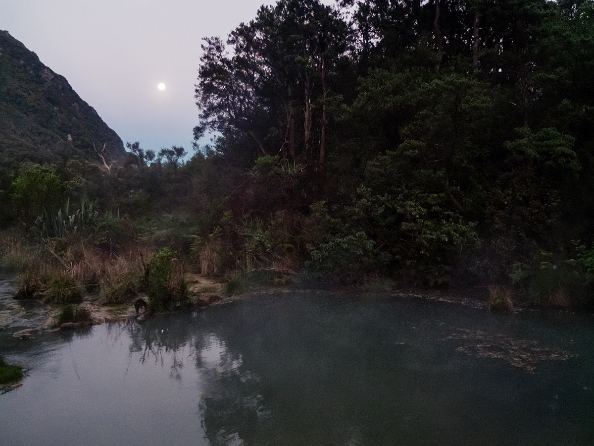
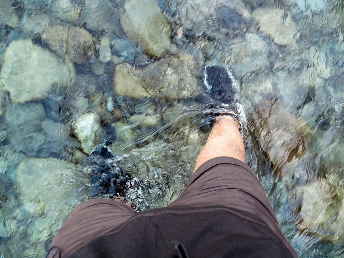
On my way up the West Coast there was one more walk I wanted to do: the Copland Track as far as Welcome Flat. Here there are natural hot pools to soak in, which I gladly did until dizzy from the heat, and another cosy mountain hut. The surroundings were spectacular and I regretted not being able to explore further up the valley. With only enough food for the overnight trip it wasn’t an option so I headed back out to the road, marking the fifth day of walking at least 20 kilometres and feeling like every single one was absolutely worth it.
There are so few roads in the South Island that a lot of the best scenery is only accessible on foot. Because of this it stays remarkably unspoiled. There must be increasingly few wild places that are so easy to access yet so similar to how they would have been thousands of years ago.
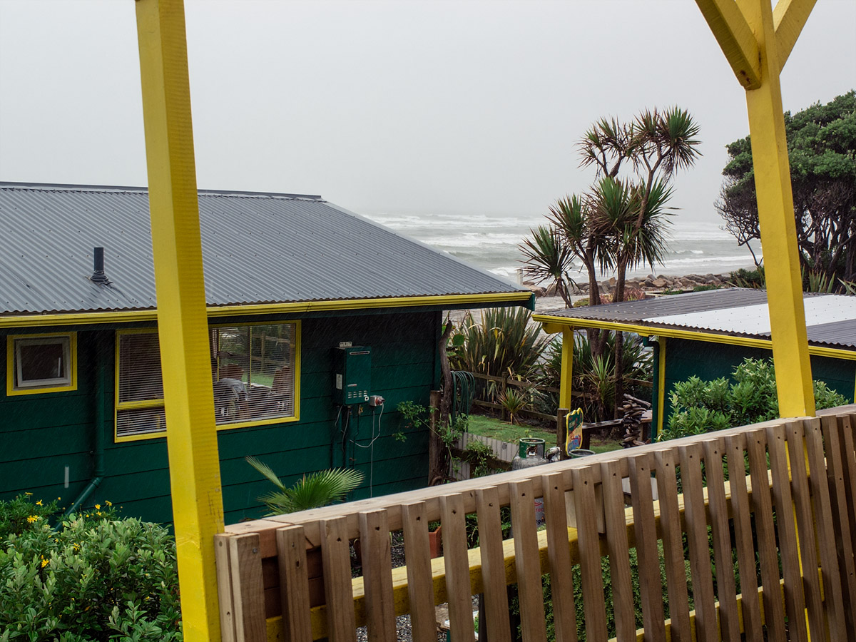
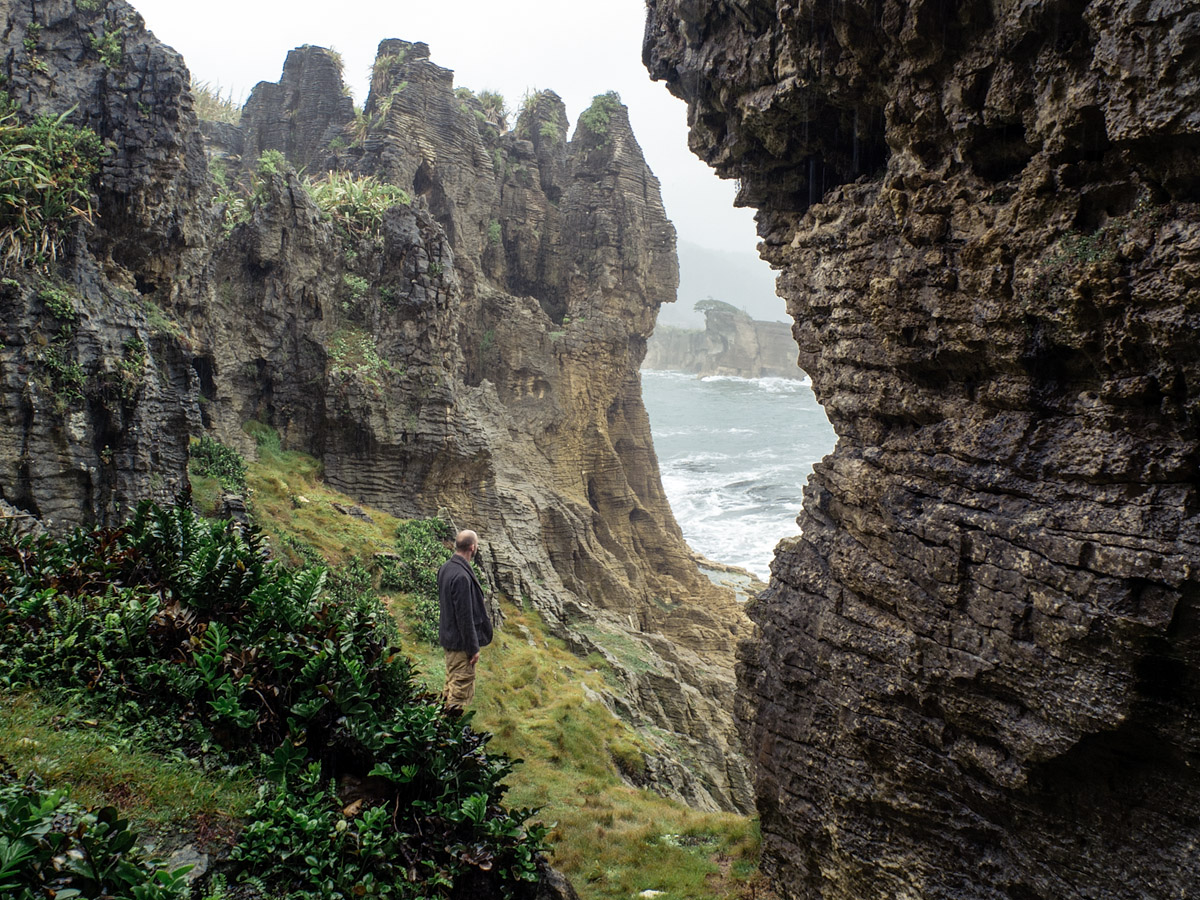
After the Copland track I continued up the coast as far north as Punakaiki. I had some bad weather here which luckily coincided with my plan to camp at a hostel. It was only supposed to be for one night but, thanks to some good people in good accommodation in a beautiful location, I was glad that the rain forced me into a second.
* * *
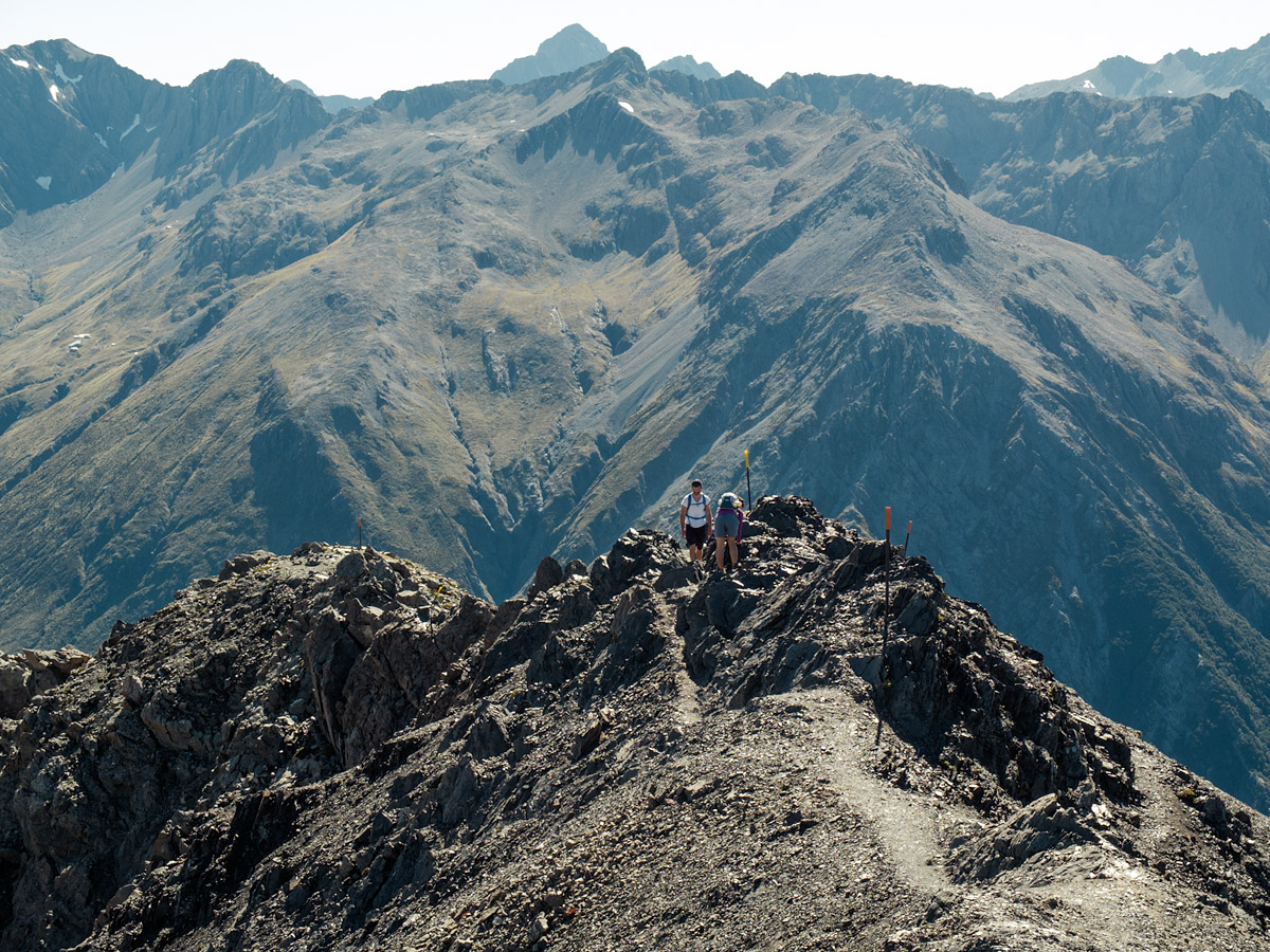
I crossed from the West Coast to the East via Arthur’s Pass. On a recommendation and a whim I did one more overnight walk, climbing Avalanche Peak and looping back to the road via the Crow River.
It was one of the more rugged walks I’d done. A lot of the time there was no track, navigating meant following a ridgeline or a river and there was a 600m scree slope to descend. Here it really sunk in how much I was going to miss these wildernesses. When I finished it felt like I could have carried on indefinitely. But at the same time I was pleased to have left Queenstown with a plan and to have completed it—a marked contrast to my first few weeks in New Zealand.
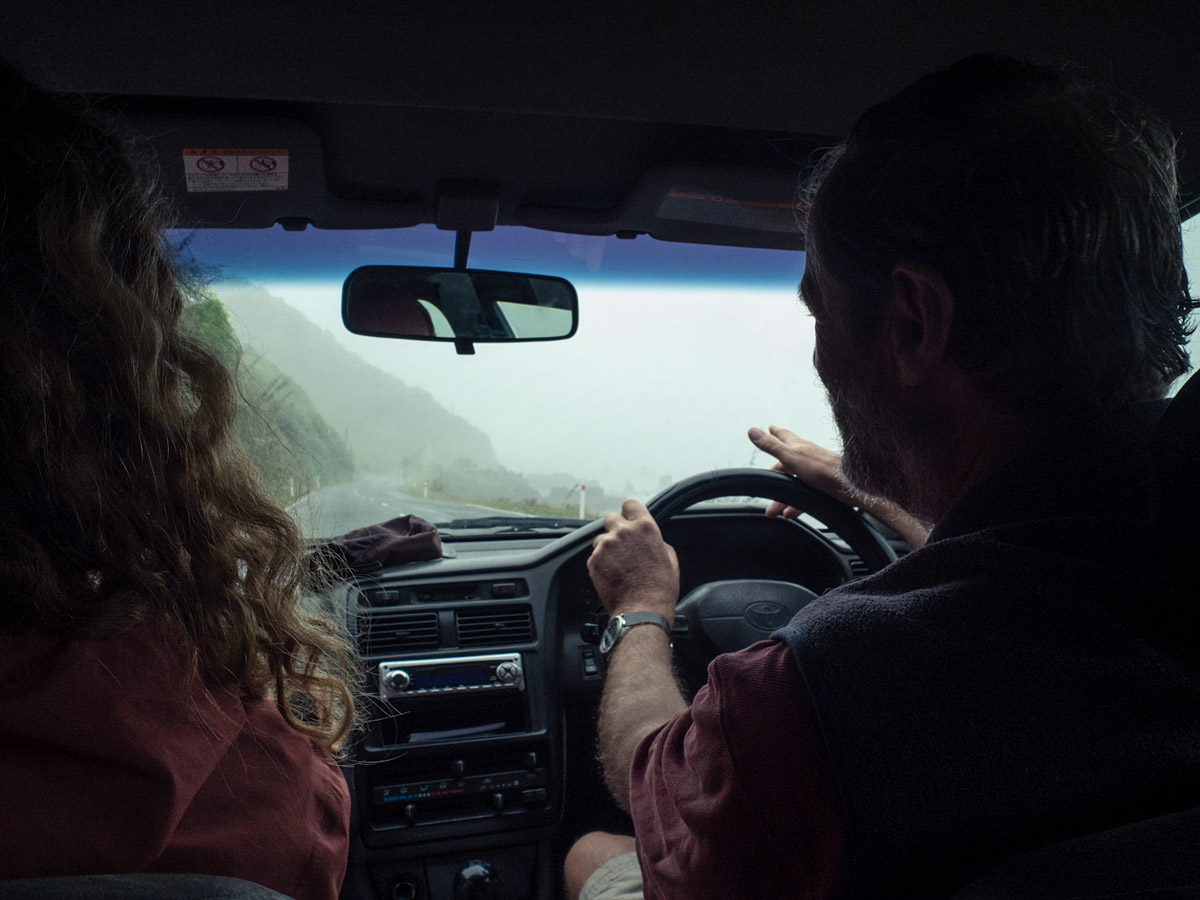
Hitchiking, or the view from the near side rear seat
I travelled the whole of this section of the trip by standing beside the road and sticking my thumb out. At most I waited an hour for someone to stop; generally it took less than ten minutes and a couple of times less than one. Many thanks to the following people:
- Australian newlyweds on their honeymoon. She was called Crystal and it was Valentine’s Day. (Raspberry Creek car park to Blue Pools via Wanaka, 121km)
- A couple from Belarus and the Ukraine. He was a software developer working on an offline mapping app for travelling when abroad. (Blue Pools to Monro Beach via Haast, 104km)
- A retired couple from The Netherlands in their hired campervan who fastidiously compared notes with me on the countries I’d visited and those I hadn’t but should. (Monro Beach to Copland Track, 62km)
- A young German couple who were searching for freedom in an estate car filled to the roof with stuff. (Copland Track to Fox Glacier access road, 24km)
- An English physiotherapist and her accountant friend who was booked on the exact same flight as me out of Christchurch. (Fox Glacier access road to Fox Glacier town via a walk to the glacier viewpoint, 9km)
- A German couple who played German music and didn’t say a lot. (Fox Glacier to Franz Josef, 24km)
- A German daughter who spoke English and her mother who required some translating, but who still enjoyed listening to Take That. (Franz Josef to Hokitika, 134km)
- A dairy farmer on the way to a meeting with the electricity company. Printed in colour on a sheet of A4 and taped to the centre console, just out of the corner of his vision, was a picture of his wife underscored with the year of her birth and the year of her death (2012). I imagine he spent a lot of time driving. (Hokitika to Greymouth, 39km)
- A retired Kiwi couple who’d lived in the area their whole working lives. She mourned the decline of the local industries and said that the sense of community was in danger of going with it. (Greymouth to Punakaki, 45km)
- A hostel owner making his weekly trip into town for supplies. As I got out of the car he told me to remember that it was about the journey, not the destination. (Punakaiki to Greymouth, 45km).
- A new father heading home from the hospital to fetch some things for his wife. He unwrapped and ate an egg sandwich with his left hand and changed gear with his right. A blue cocktail umbrella was pierced into the trim above the glovebox. (Greymouth to Kumara Junction, 16km).
- A former radio DJ who now made his living giving presentations to hotel owners about how to better market their businesses. He emphasised how he could party just as hard past the age of forty and talked about (occasionally) smoking weed with all the awkward pride of fourteen. As I shook his hand goodbye I noticed a cartoonishly-shaped silver cross hanging where the top two buttons of his shirt were left undone. (Kumara Junction to Arthurs Pass, 78km)
- Two English guys and a Kiwi on their way back from a surfing trip. One of the former was from the same town as me, had gone to the same university and was soon leaving New Zealand. He’d be flying west, I’d be flying east. (Klondyke Corner to Riccarton, Christchurch, 134km)
—
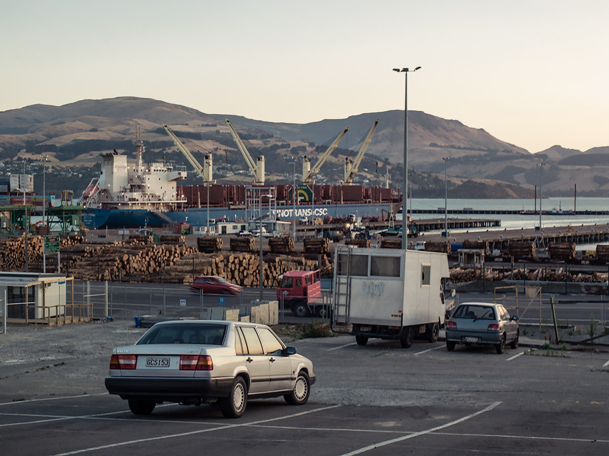
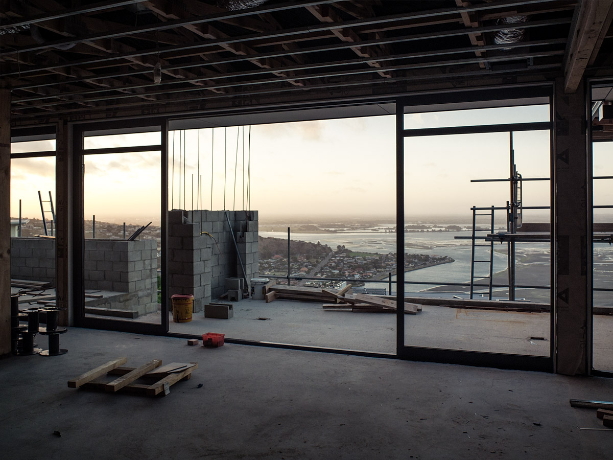
Before flying out of Christchurch I spent a week staying with Pete, another English BMXer who has moved to New Zealand. He is a civil engineer working on rebuilding the city after the earthquakes of three years ago. While the still-present devastation was tragic it made it unlike anywhere else I’d been. To be able to understand better—thanks to Pete’s involvement—what had happened and was happening was really interesting.
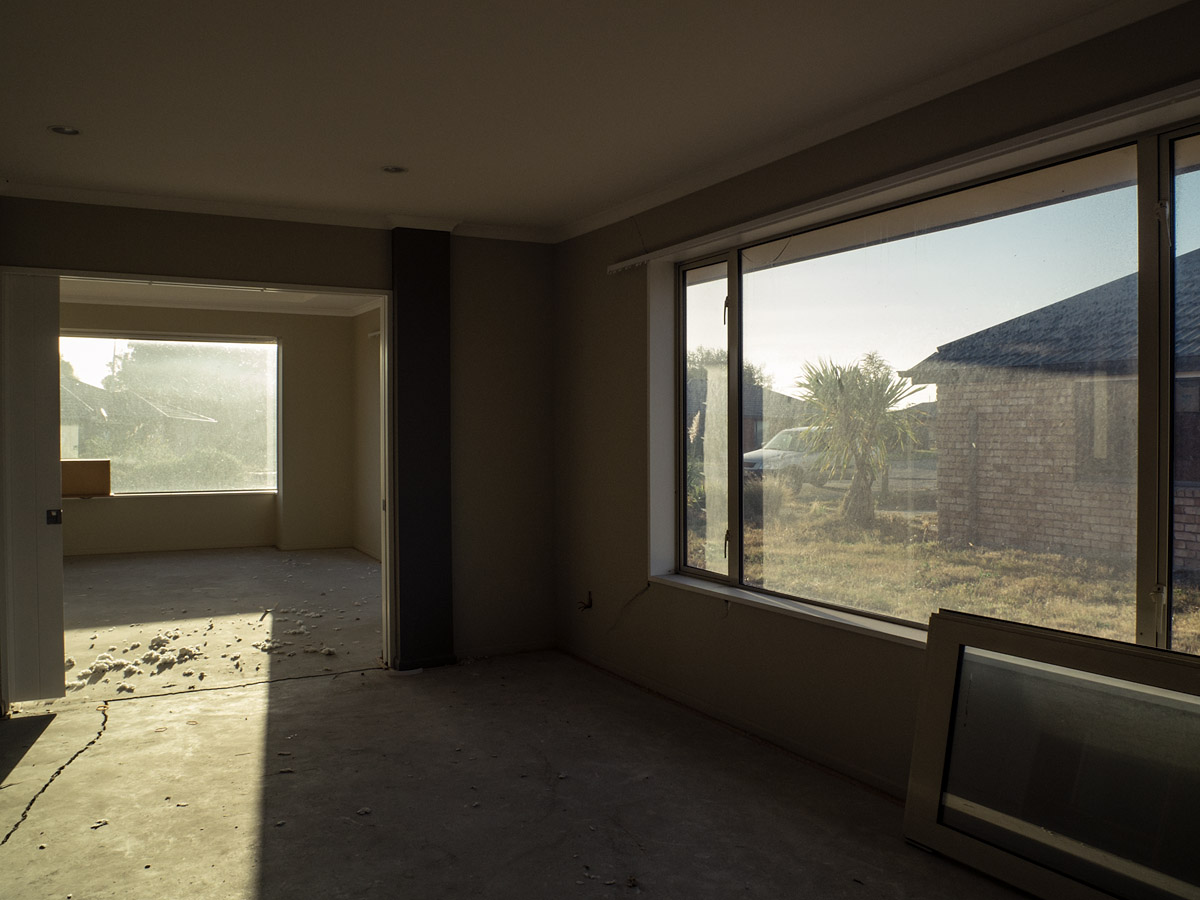
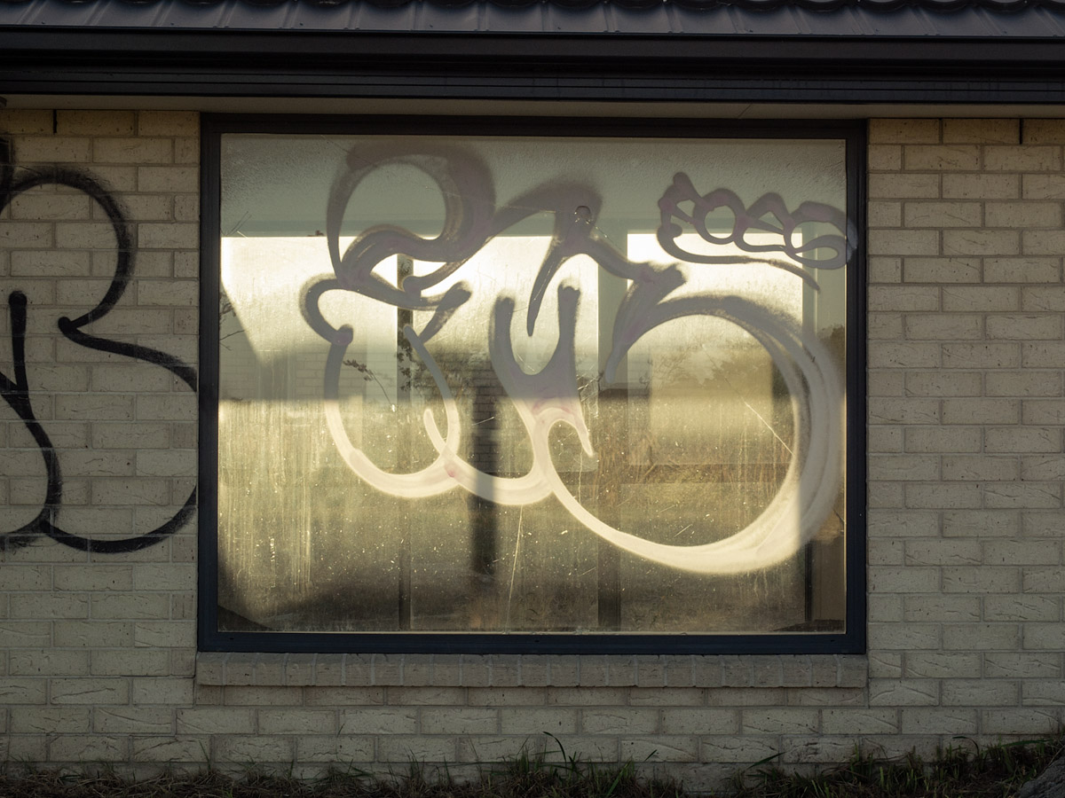
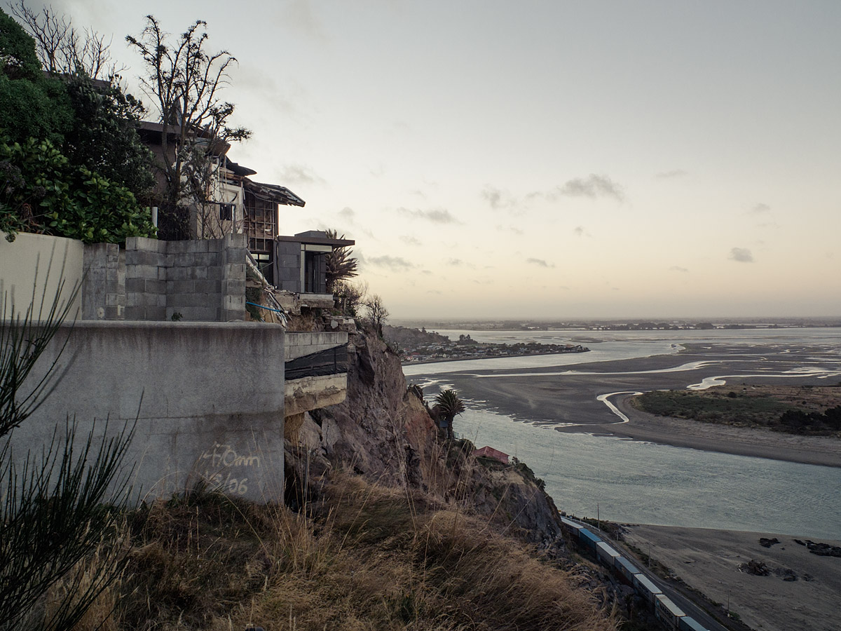
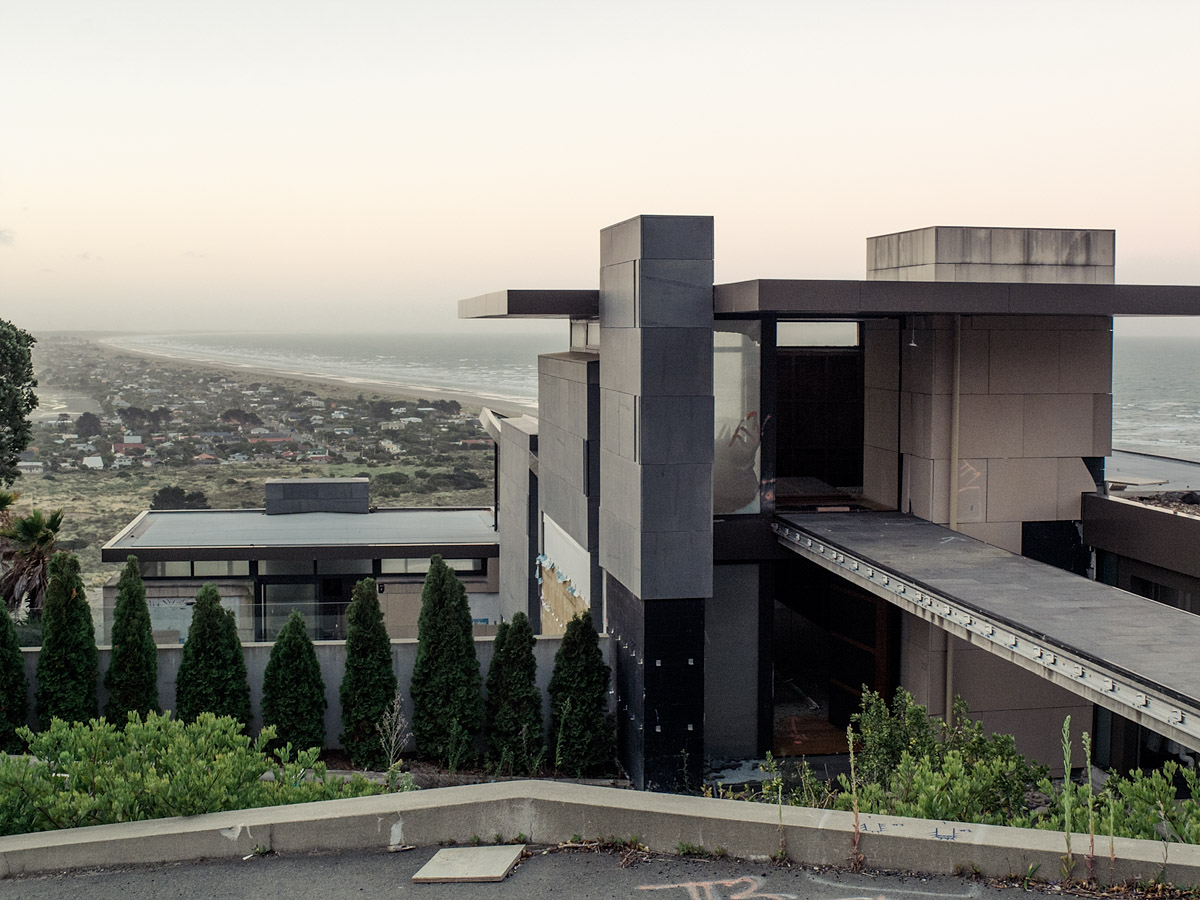
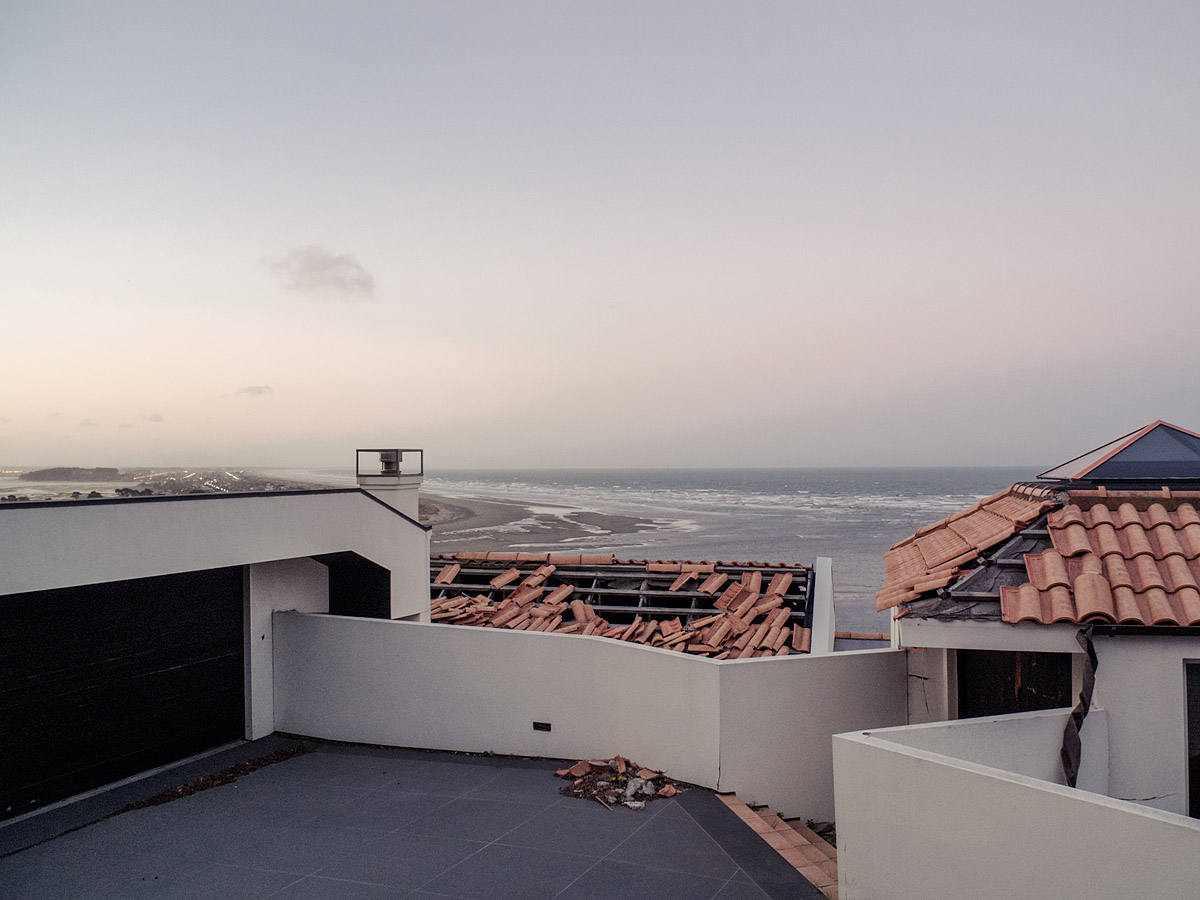
All over the city, especially in the centre, there are empty spaces where buildings should—would—be. Virtually none of the premises still standing are open for business. Further out there are large areas which have been “red-zoned”, condemned for demolition without the immediate possibility of rebuilding—the land is too unsound or too vulnerable to rock fall. It doesn’t seem incongruous, visiting these areas, that the term sounds like something from a zombie film. They estimate that it will be 5–10 years before some semblance of normality is restored.
* * *
It was a week of easy living in the suburbs and the surf. It should have given me time to reflect on the trip I was leaving—very different to the one I’d begun—a story, written with contrails, tyre marks and footprints; in dust, ashes, and wakes; but it was a story not yet laid to rest.
There’s little sense in a story without an ending and there’s no sense, only destruction, in an ending that comes too soon. My New Zealand experience was richer for having documented it here, for being able to demarcate it into chapters. Arriving in Christchurch closed one of those chapters. Leaving, however, did not. It was the middle of a new one whose ending’s time was still to come.
—